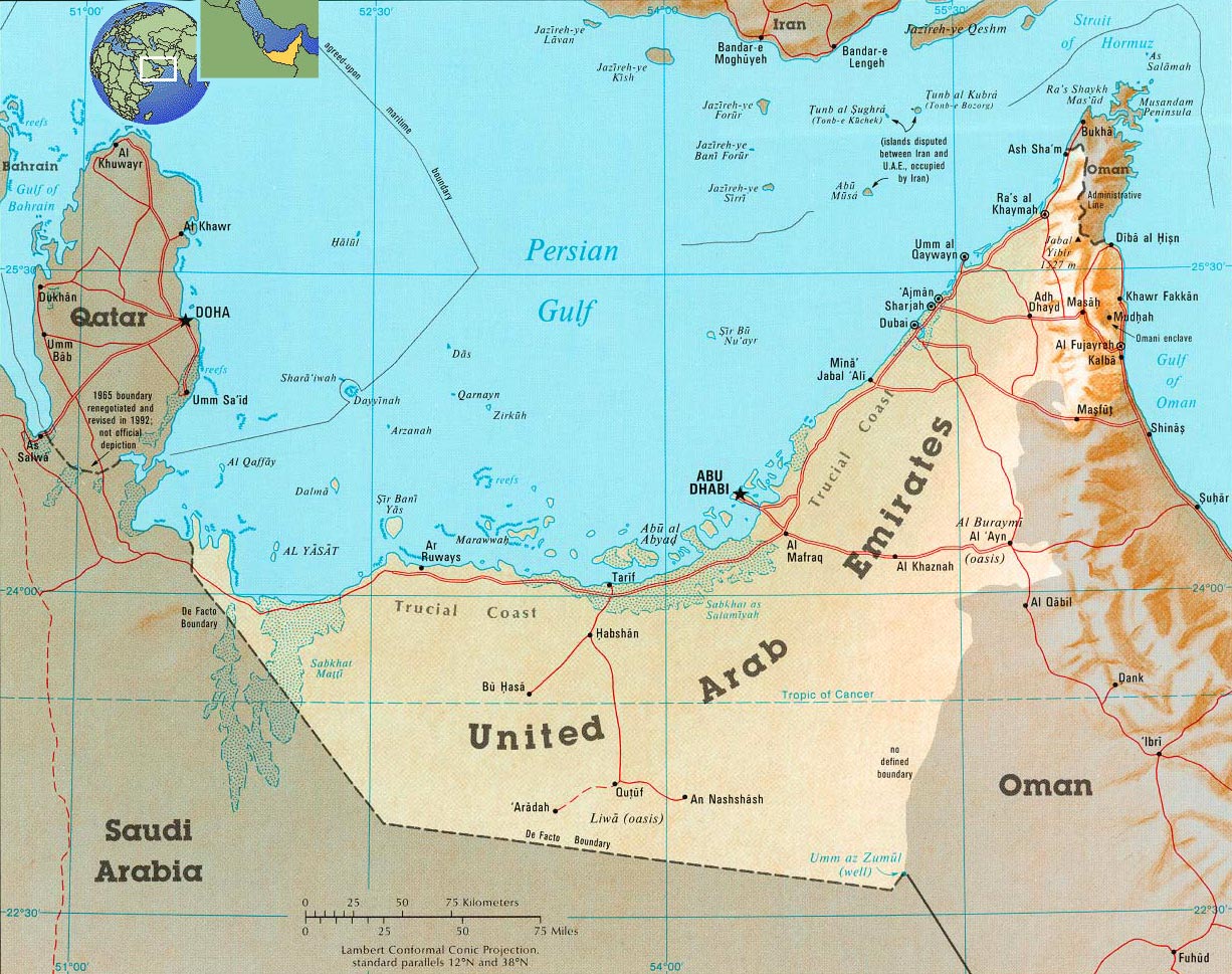
United Arab Emirates Map
It is a federation of countries composed by seven emirates. They are located in the Southeast of the Arabian Peninsula, on the Persian Gulf, bordered by Saudi Arabia to the South; by Qatar and Oman to the West. The indigenous population is mostly Arab and Muslim. Its terrain is flat, barren coastal plain merging into rolling sand dunes of vast desert wasteland; mountains in east. It lacks of natural freshwater resources compensated by desalination plants; desertification; beach pollution from oil spills.
|
Copyright © Geographic Guide - Asia Atlas, Maps of Countries. |
All rights reserved |